Saturday, March 30, 2024

Why's It So Hard to Keep Track of Easter?


Jeff––Saturday

No disrespect intended.  It’s a serious question. 

I  think most of us are aware that Easter is celebrated by Western Christianity and by Orthodox Christianity more often than not on different days. Last year they were celebrated a week apart, this year they're separated by the entire month of April.  Having no fixed date, that's why Easter is called a moveable feast, unlike Christmas…at least for most.

So, why is there such uncertainty over determining the date of this seminal holiday so significant to so much of the world? There are two answers–one easy, one not. The simple answer is that Greeks and others of the Orthodox faith calculate their Easter based upon the Julian calendar, while Western Christianity uses the modern Gregorian Calendar. If you want to know precisely how the date is determined, the explanation begins to sound strangely reminiscent of one attempting to explain how algorithms work.
 

First Council of Nicaea (325)

Officially, I understand the First Ecumenical Synod ruled in 325 that Easter Sunday should fall on the Sunday that follows the first full moon after the vernal equinox (the point at which the ecliptic intersects the celestial equator, the sun having a northerly motion) and the invariable date of the vernal equinox is March 21.  If the full moon happens to fall on a Sunday, Easter is observed the following Sunday.

Before the year 325 the determination of the date for Easter (or Pascha) seemed relatively easy.  Just ask the Jews in your community when they celebrated Passover according to the lunar-based Hebrew Calendar (now into its 5784th year), because the Jewish Holiday of Passover (or Pesach) was the occasion for the Last Supper.  The only dispute appeared to be over whether Easter should be celebrated on the Hebrew calendar’s date of Nisan 14 or the following Sunday.

Original mural by Leonardo Da Vinci between 1495-1498

The First Ecumenical Synod changed all that by calculating the exact date of Easter from the more modern cycles of the sun-based Julian calendar.  And even though some in the Church did not agree with that determination, it became Christianity’s generally accepted method for calculating the date of Easter and continued to be so for more than five hundred years after the Great Schism of 1052 separated the Church of the West to Rome and the Church of the East to Constantinople (Istanbul).

Pope Gregory XIII (1502-1585)
But in 1582 Pope Gregory XIII introduced what is known as the Gregorian calendar for the express purpose of correctly calculating Easter, something the Julian calendar was not believed to have achieved.  Today, the Gregorian calendar is the world’s officially accepted civil calendar (except in Greece’s 1500 year-old monastic community of Mount Athos—see Prey on Patmos), but there still is not agreement among the Christian world over whether it correctly fixes the date of Easter.

Indeed, as recently as 1997 the World Council of Churches proposed a method of using modern scientific knowledge for precisely calculating Easter and replacing divergent practices.  It was not adopted.

All of which means that (based upon our everyday calendar), Easter for Western Christianity always falls on a Sunday between March 22 and April 25, and for most of Eastern Orthodoxy on a Sunday between April 4 and May 8—at least during the 21st Century.

As for how Passover fits into all this, Julian calendar Easter always falls on a Sunday after the first day of the eight-day Passover holiday (and generally within those eight days), but Gregorian calendar observers who might think of tempting their Jewish friends with offers of treasured chocolate bunnies forbidden to their friends during that observant period should keep in mind that on the Gregorian calendar Passover will at times fall after Easter.  My buddies in the old neighborhood learned that lesson the hard way.

But no matter what calendar you follow, with all my heart I wish you a Happy Easter for tomorrow, a Zissen Pesach for April 22nd, and Kalo Paska for May 5th--plus as a bonus to my baby brother born on Cinco de Mayo, HAPPY BIRTHDAY BIG AL. 


––Jeff

Thursday, March 28, 2024

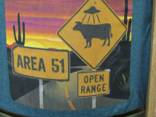
Area 51


There appear to be lots of conspiracy theories about Area 51, UFO’s and aliens so I thought ‘I’d go with a reliable source for this blog- The National Geographic.


It seems to be that the National Geographic is actually owned by Disney so should I believe anything about Area 51 when it is told to us by a man who created a six-foot mouse who wears shorts, gloves but no shirt.


So, area 51 lies low in the Nevada desert. The military have a large and ‘secret’ presence there (lots of empty desert surrounded by a fence) but it's mostly associated with aliens and UFO sightings. It created a lot of excitement, amongst the men, on the tour when we pulled into the Area 51 petrol station. Even more excitement was created by the sight of the cat brothel.


People (men mostly) flock from all round the world to hopefully to catch a glimpse of an alien. Or of the ladies in the brothel.


Many of the sightings have been discredited over the years. I confess I knew nothing about Area 51 apart from being able to whistle the theme from the X-Files, badly.


The road that Area 51 sits on, is known as the Extraterrestrial Highway


The truth, very boringly, probably lies in the experimental aircraft that are tested in the area. The secret activities were admitted by the USA government in 2013 and spoiled everybody’s fun. The  exact nature of the secret activities within the very active military base still remain exactly that- a secret.


 When one very high-tech craft (the A-12) was being tested and had nearly 3000 take-offs, its titanium body reflected the desert sun in a way that not many people had seen before. The reports of UFO sightings rocketed as much as the craft itself did.


The petrol station has a shop with 100s of tee shirts- mostly rude.
A diner, a brothel, a good coffee machine - all at prices that were remarkably fair.


The set-up at the petrol station is run by lovely men who seem themselves to be rather unworldly- they look exactly as you'd expect. An air of humourous disappointment follows in their wake,  one eye on the sky for something more exciting than a load of Brits emptying their coffee machine and buying polky hats ( ice cream- nothing to do with a probe), and looking at the model of the USS Enterprise.


The McDonalds in Roswell, New Mexico is shaped like a spaceship.


This one was my favourite....


So what do they want us to believe.

Cue Mulder, Scully and the music.

The truth is out there.


Tigers in Africa


Sunset at Tiger Canyon

Yes, there are wild tigers in Africa, and yes, there are wild rhinos in Australia. Both areas were set up as backstop conservation models. Habitat destruction in Asia and poaching have reduced the wild tiger population worldwide to some 4,000 animals. Tigers in captivity exceed that, but there are still less than ten thousand individuals alive in total. Furthermore, there are important subspecies and varieties such as the white tigers (not albinos but a genetic variety). The only two wild white tigers in the world are at Tiger Canyon, a game reserve in South Africa.

Tigo, one of the "white" variety tigers

Two of Tigo's cubs, now youngsters
Not white. The gene is recessive.

Having a rough-and-tumble


I mentioned Tiger Canyon in my blog about photographer Marsel van Oosten a few weeks ago. After seeing his pictures and hearing the story of Tiger Canyon (which I didn’t know before), we were keen to visit. We managed to stay there for one night last month on our way from Knysna up to Olifants River Game Reserve, and it was wonderful. Tigers are magnificent animals, the largest and most beautiful of the big cats, and if these were in an adopted environment, they seemed to be very much at home there. They hunt and pull down large antelope. They are used to people, but so are lions at Olifants. People are ignored - they are not food, and as long as they don’t interfere they are tolerated. But there is no doubt that these animals are wild. No one would be tempted to go near them on foot. It wasn’t always like that way.

John Varty with Tigress Julie, founding members together

A well-known South African conservationist and film maker, John Varty, was the brains behind the project. Discouraged by a visit to various tiger reserves in India more than twenty years ago, he planned a conservation area for tigers in the center of South Africa. Although the area had been used to graze sheep in the past, he could see that the farms could be regenerated. That happened, and many local species of birds and small animals have returned over time. The large herbivore species beloved of the lions in the rest of Africa were reintroduced, but obviously there was concern about whether tigers would be willing and able to hunt them. The tigers are there to live wild, catch their own food, build their own social groups, breed. They are not in a zoo. No hunting means no food.

The tigers all originate from genetically diverse individuals who were originally in captivity, and it remains essential to introduce new blood. The road hasn’t been smooth. The project attracted controversy for all sorts of reasons. Rewilding big cats hasn’t always been successful. Would local livestock be in danger if the tigers escaped from the game reserve? (Yes.) Tigers are territorial and aggressive. Would that be a problem? (Yes, two tigers were killed by other tigers and now they are in three large but isolated areas.)

The story goes that John Varty approached local sheep farmers as someone interested in farming himself. The seller whose magnificent river canyon runs through his farm carefully didn’t mention it because it’s not great for sheep who sometimes fall off the rock cliffs. So Varty only discovered after the sale that he had some magnificent landscape on which to build a lodge, and great topography for tigers who like rocky outcrops.

Tigress Julie Lodge overlooking the canyon

The view of the canyon

Two of the smaller canyon inhabitants - rock hyrax

Varty calls Tiger Canyon a work in progress. There is still a long way to go. Much more land is needed so that the tigers can spread out and maintain their territories without violent aggression. The gene pool needs to grow. There are currently less than twenty tigers over 15,000 acres. But it’s a start. And just maybe one day it will be a vital repository of wild tigers.

Wednesday, March 27, 2024

When A Bridge Falls

 SUJATA MASSEY


                                                    Photo courtesy PBS


Like so many Baltimoreans, I spent yesterday on the phone telling friends and relatives that I was alive. No, I hadn’t been anywhere near the Francis Scott Key Bridge early Tuesday morning. But I was following the news from before sunrise, because my email carried an emergency bulletin from the city. A bridge had collapsed—not just any bridge, but one bearing the name of The Star Spangled Banner’s author—a man who had witnessed the British attack on the Baltimore Harbor during the War of 1812 and written the song in honor of the defending Americans at Fort McHenry.


One of the first matters raised in the press and private conversation was whether this shocking collision had been an attack. A falling bridge reminded me of falling towers. And ships are supposed to be protected with backup systems should power be lost--so what happened?


The Dali, a cargo ship carrying containers bound for Sri Lanka, reportedly had its lights flicker off before they came back on, leading to speculation that a generator did kick in. Still, the crew realized they could not control the ship’s propulsion and issued a May Day signal. Fortunately, the alert was received and communicated instantly by the Maryland Department of Transportation. Police closed vehicle entry to the bridge just before the Dali hit one of the bridge’s major supports. 


That was too late for a small group of construction workers atop the bridge, because after the collision, the bridge collapsed in forty seconds. Two men were rescued from the water, and the Coast Guard has announced that it’s unlikely the remaining six workers could have survived the cold waters this long. Of course, some cars might have already been on the bridge when it was closed; so there may be more cars and bodies submerged in the water.  


According to a colleague who knew the crew, they were immigrants from El Salvador, Mexico, Honduras, and Guatemala. The workers were employed by a Baltimore County contractor who supplied labor for bridge repair and construction. Baltimore is the country’s largest point of entry for foreign cars, and overall, its third largest industrial port. And it’s one of the nation’s oldest ports, dating from the beginning of the 17th century, when tobacco was the chief imported product. The early locations were Fells Point, a beautifully preserved waterfront district, and then and Inner Harbor that edges our downtown area. The original owners of the 1897 house I live in had a saloon on Water Street near that harbor, which was a bustling, rowdy locale. As decades passed, more areas to receive cargo were built further out from the city itself. The northwest areas of the Patapsco River are the location of side of the Helen Delich Bentley Port of Baltimore, the chief industrial port. 


The Dali was built by Hyundai in South Korea in 2016. After the Dali had an accident involving propulsion at the Antwerp, Belgium Harbor, its first owner sold it to a Singapore Company, Grace Ocean Pte Limited. The ship’s technical state was managed by a company called Synergy that reportedly has a history of three worker deaths on their vessels since 2018. The 22 crew members of the Dali are Indian, and they are still on the boat, along with many of the 4600 20-foot containers of cargo. It seems miraculous that the whole crew survived the bridge collapse. 


Civil engineers, boat experts, and veteran seafarers will be busy explaining the cause of the accident—ship company, bridge design, and perhaps something else--for months to come. 


Yet I imagine that the construction workers on the bridge were in the wrong place at the wrong time only because they’d had to leave dangerous homelands. Upon arrival in Baltimore, they found jobs that ensured American comfort: raking leaves, cleaning bathrooms, digging up and repaving roads.  For the Dali’s Indian crew, the motivation was likely similar. The promise of a decent paycheck sends many young Indians abroad to jobs where they work overly long hours under difficult conditions


Until the bridge accident is cleaned up, Baltimore’s port will be closed to traffic. The cost of the lost business, and rebuilding the bridge, are huge; even if the latter is paid for by U.S. taxpayers and shipping insurance. But it’s also a very great cost to our humanity, if we forget that those most hurt by the bridge crash are the folks do the invisible work of making our life easier. And we will likely never know their names. 

Tuesday, March 26, 2024

Fasting for Renewal, Caterpillars & Renovation Update

Ovidia--every other Tuesday

Right now in Singapore we're in a 'fasting' period leading up to two big festivals:

For Christians we are in Lent, leading up to Easter. This is the time between Jesus' entry into Jerusalem and his life, death and resurrection. Lent is a time of prayer, fasting and charity and a reminder that when things seem darkest, things are yet working to bring about greater good than we can imagine.

For Muslims, we are in Ramadan, the period of fasting leading to Hari Raya Aidilfitri. Ramadan marks the time when Prophet Mohammed received the first verses of the Qu'ran. 
Fasting during the daylight hours is a private act of worship that brings about spiritual discipline and empathy with the less fortunate.

In both cases, the joy and celebration of Easter and Hari Raya Aidilfitri are preceded by periods of fasting and reflection, reconstruction and renewal. Almost as though we need to pause and prepare ourselves before we can move on.

It's a pattern that also shows up in nature as well as in our our own lives, I believe. 

This is the chrysalis phase of metamorphosis. An uncomfortable time for the encased caterpillar who isn't able to eat or even move as its body tissue breaks down and the very cells of its muscles and organs dissolve... and the imaginal discs (undifferentiated till now) develop into the wings, legs or antennae they were destined to be from the start.

The emerging butterfly or moth leaves behind in its chrysalis the gooey waste from its previous incarnation. And maybe to keep evolving towards our full potential we need to do the same?

I would really like to think so!
Because right now we are still in a state of upheaval in our current state of evolution/ metamorphois: 

Though the insides are definitely looking better!


At least we can see where the fixtures are going to go!


All the fixtures are supposed to be arriving this week, after much discussion between contractor,  suppliers and workmen on existing plumbing and the relative merits of S- traps (easier to install in existing structure) and P- traps (the latest thing in toilet technology, apparently!)

But it's all still a bit chaotic on the outside... I'm most sorry for the neighbours whose lives we've been discombobulating, but so far everyone has been very sweet and supportive and curious--at least two are interested in getting our contractor to do some work for them... after they've seen the results here. I hope we're a good advertisement for him!


I've run away from it all for now. This is where I've ensconced myself during the day-- the view from the front of the library...


This being Singapore, construction and reconstruction are going on everywhere. We know that behind the protective facade furious work is going on.

And in the library itself all is calm, air-conditioned quiet...


My current chrysalis/ cocoon. This has become my favourite spot in the library! It's quiet with a view of the sky and palm trees, there are chargers for my MacBook and phone, I can spread my stuff on the window ledge... and it's only a short walk (2 bookshelves) to the loo and a little further to the water cooler!


Sunday, March 24, 2024

The Lunatic Express Again


Annamaria on Monday

This past week, a writer friend told me that he has, in his future, a meeting with a person who is researching "railroads in East Africa!"  He asked me if one of my books takes place against the building of the railway. But that all happened about seventeen years before my stories start.  The railway is, however, an essential part in most of my stories.  My characters travel by train, beginning with the first book in the series: Strange Gods, just now out in a new edition. 


Since the new edition of that book just launched, I took that question as a suggestion for today's blog.  Here is repost of my blog about the creation of what came to be known as "The Lunatic Express."


It was called the Uganda Railway, but all of it was in the Protectorate of British East Africa, now Kenya.  It goes 660 miles from the port city of Mombasa, on the Indian Ocean, to Kisumu on the Eastern shores of Lake Victoria, across the water from Uganda.


It is credited with cementing Britain’s colonial power in East Africa.


But also with being instrumental in stopping the “trail of tears”—the route where slaves were dragged from the interior to the coast and then shipped to work in the households of Asia Minor and on the sesame plantations of the Zanzibar.

Construction began in 1896.  It cost Great Britain’s taxpayers 55 million pounds sterling: £20.1 Billion or $33 Billion in today’s money.


If the indigenous people tried to stop its progress through their territory, “punitive expeditions” were sent out to put them in their place.  Keep in mind that the King's African Rifles had firearms.  The tribal people fought with iron (not even steel) spears and swords.  Still, the Maasai won one of those battles.


32,000 Indians were shipped in from the Raj to build it.  6,724 of them stayed after the work was done and made a life there—many of their descendants remain today.  

It crosses 35 viaducts, 120 bridges and culverts.


Its engineers and construction crews braved man-eating lions and deadly scorpions.

2,498 perished during its construction.

Before the Brits built the railroad, the route from Mombasa to Kisumu was an oxcart trail.  To traverse from the coast took about three months with most of the party walking, carrying water and food.  Ordinarily around three hundred at a time, most of them tribal porters, made the trip.  People died.

A new way to travel that distance was called for.  But not everyone agreed.

Calling the railroad a “gigantic folly,” Liberals in Parliament were against the project, saying that Britain had no right to drive what African’s called the “Iron Snake” through Maasai territory.  The magazine Punch called it “the Lunatic Line.”  In 1971, Charles Miller wrote a book about it: The Lunatic Express: An Entertainment in Imperialism.  Many politicians and newspaper editors called it a waste of the taxpayer’s money.  Shaky wooden trestles over enormous chasms, hostile tribes, workers dying of until-then unknown diseases—much of what transpired seemed to support those against the idea.


But from the outset, the Uganda Railroad had its adherents.   Conservatives saw it as an important salvo in the “Scramble for Africa,” that Nineteenth Century madness of the European powers to take over whatever chunks of the African continent they could lay their hegemony on.  Winston Churchill admired it as “a brilliant conception."  He said, “The British art of ‘muddling through’ is seen here in one of its finest expositions.  Through everything—through forests, through the ravines, through troops of marauding lions, through famine, through war, through five years of excoriating Parliamentary debate, muddled and marched the railway.”


In the end it was seen as a huge achievement—both strategically and economically.  It became vital to the suppression of slavery.  Its existence eliminated the need for huge squads of human beings to carry goods.


The American President Teddy Roosevelt rode the railroad during his visit to British East Africa in 1909.  He wrote, "The railroad, the embodiment of the eager, masterful, materialistic civilization of today, was pushed through a region in which nature, both as regards wild man and beast, does not differ materially from what was in Europe during the late Pleistocene."  On his way into the interior from the coast, he often rode on a platform on the front of the locomotive, giving him a great vantage point for viewing the huge array of wildlife along the way.  According to Teddy, "...on this, except at mealtime, I spent most of the hours of daylight."  It's a view I sorely wish I could have seen.

Here is a link to give you a glimpse of the line as it passes through some of the most incredible scenery on earth, as shown in the opening credits of Sydney Pollack’s brilliant Out of Africa.

 htttp://www.youtube.com/watch?v=9FB1LS3WhIU


Saturday, March 23, 2024

A Looming Threat for the Greek Isles


Saturday––Jeff

“The combination of increased water consumption and prolonged drought is depleting resources in the Cyclades.”

That’s the headline of an in-depth investigative report by environmental reporter Giorgos Lialios, published yesterday in Ekathimerini, Greece’s newspaper of record.  It’s a subject I’ve observed firsthand for over a decade and listened even longer to locals openly worry over.  

What follows is Mr Lialios’ report.  The words are all his, not mine, but I know many of the islands mentioned well (no pun intended), what with my wife and I spending much time on many of them and my setting a half-dozen of my books on those islands.  I take his article as a call to action. We shall see.


Year after year, the pressure increases. On the one hand, there is the explosive growth of tourism, followed by an increase in consumption; on the other, there is drought. The small Aegean islands are preparing for the start of the tourist season with their reservoirs empty, their boreholes pumping brackish water, and an increasing dependence on desalination. The first victim of this difficult situation is what agricultural production is left on the islands, according to the doctrine of “water for the people first and then everything else.”

In 2023, rainfall in the Aegean will be limited for a third consecutive year. “Especially in the Cyclades and southern Crete, which are the areas with the least rainfall, 2023 was a bad year,” explains Kostas Lagouvardos, meteorologist and research director at the National Observatory of Athens. “The last good year for the Aegean was 2019, with a lot of rain in the east and south. Since then, rainfall has been below average. Especially in the Cyclades, where the rainy season lasts only five or six months, it only takes two bad years to create a problem.” In 2023 Andros received 363 millimeters of rain, compared to an average of 506 mm, Tinos received 299 mm, compared to an average of 330 mm, Naxos received 270 mm, compared to an average of 306 mm, and Ios received 195 mm, compared to an average of 285 mm. 


As a result, the Aegean islands are preparing for a difficult year. “The reservoirs on the islands are empty. Many islands will have problems this year. And the first victims will be crop growers and livestock breeders. If it doesn’t rain, there is no vegetation, so the farmer has to buy fodder. Last year the farmers of Naxos bought bales of clover from Bulgaria,” explains Ilias Nokas, head of the Directorate of South Aegean Water at the Decentralized Administration of the Aegean.

“Naxos has two dams. Last year they had 375,000 cubic meters of water, this year they have 30,000 cubic meters of water,” says Dimitris Lianos, mayor of the island. “We’re going to struggle this year. It’s not just tourism that’s important to us, but also agriculture and livestock farming. The first to be affected are the farmers. Potato farmers are already thinking of not planting this year because they will not be able to water their crops. It will be a difficult year for everyone. However, compared to most of the Cyclades islands, Naxos is still in a better position. “The island has water, we have two boreholes at a depth of 171 meters with very good quality water and the level has not dropped. What the island needs is a master plan for water supply. Unfortunately, because of localism, we cannot make more rational use of the water supply – some villages exploit springs and do not allow others to be supplied with water. The town of Naxos now has a desalination plant. We also need irrigation networks and targeted policies for farmers and livestock farmers so that they do not give up; the primary sector is our added value.”


Mykonos

On islands where meeting the needs of tourism is the only priority, empty reservoirs aggravate an already difficult situation. Mykonos is a typical example. “The Municipal Water Supply and Sewerage Company of Mykonos has two dams and two desalination plants to supply water to the island,” explains the company’s chairman, Dimitris Lazaridis. “The Marathi dam, with a capacity of 3 million cubic meters, and the Ano Mera dam, with a capacity of 1 million cubic meters, are almost empty due to the continuous drought, and they are not being used.”

Drought is not the only problem. The Aegean islands have seen a surge in tourism in recent years, with a corresponding increase in water consumption. A typical example of the gradual increase in water consumption is the arid island of Santorini. According to data from the Municipal Enterprise for Water Supply and Sewerage (DEYA) of Thera, a decade ago (2013), water consumption on the island reached about 929,000 cubic meters. In 2023, it reached 2.36 million cubic meters of water (an increase of 13.8% compared to the previous year).

The huge increase in consumption is also reflected in the other “flagship” of the Cyclades, Mykonos.

According to data from the Mykonos DEYA, the consumption of water in 2020 (year of quarantine) was 955,505 cubic meters, in 2021 it increased to 1,174,254 cubic meters (+22.9%), in 2022 to 1,513,068 cubic meters (+28.8%), and reached 1,618,069 cubic meters in 2023 (+7%). In other words, if we consider that 2020 was not an ordinary year due to Covid-19, water consumption on Mykonos will increase by 37.8% in two years (from 2021 to 2023). “Moreover, the DEYA data does not reflect the whole picture, as 40% of the island is not covered by the water supply network. The total water consumption of the island is estimated at 2.5-3 million cubic meters per year,” Nokas said. “Like many islands, Mykonos is a place where people build where they want and then meet their needs either with private boreholes – which are overpumped, resulting in poor quality water – or by buying water. However, the increase in consumption also affects the areas that have networks because they are not properly designed. On Mykonos, for example, the network was originally built to serve only Hora, the island capital, and now supports all the outlying areas without any specifications. The island’s biological treatment plant, which was designed for a population equivalent of 50,000 and serves over 100,000 in the summer, has a similar problem. Everything is operating at capacity.”


Challenges

The administrative structure – i.e. the division of responsibilities for water – does not help the situation. Water management on the Greek islands is governed by a complex and deficient system. In the most organized cases, there is a municipal water and sewerage company responsible for the network and water production. In the less organized cases, the water is managed by an agency within the local municipality. The licensing and control of private wells, either for water supply or irrigation, drilled outside the network, is the responsibility of the water directorates of the decentralized administrations, where one or two people are called upon to manage everything. Finally, the regions have water management departments that deal with inspections and complaints.

“When it comes to water consumption, tourism has the last word,” says Nokas. Desalination is not enough. In Ermoupoli, on the island of Syros, when the first plant was built, it had a capacity of 1,200 cubic meters, and today it has reached 5,000 cubic meters, and it is still not enough. Moreover, with the increase in energy costs, the island’s DEYA, which a few years ago had a reserve of 1 million euros, is now 5 million euros in the red, which it cannot pass on to the water bills, since water is already very expensive. According to the Ministry of the Environment and Energy, there are currently 31 desalination plants in operation in the Cyclades and another 15 in the Dodecanese.


Illegal drilling

The problems are not confined to the Cyclades. On Skiathos, which is supplied exclusively by boreholes, the underground water level is falling every year. “The peculiarity of Skiathos is that we have water, the island is self-sufficient. The town of Skiathos is supplied by five municipal wells, while hotels and private individuals on the island have their own wells. In addition, since the water from the central well is no longer potable, we have installed 25 public taps in the town with potable water from another source,” says Ioannis Sarris, director of the Skiathos DEYA.

“The DEYA has no authority to license or control the wells. It has no idea what quantities are being pumped. We have done the best we can – in recent years we have replaced almost the entire internal water supply network and significantly reduced losses. What worries us is that every year the level of the water in the boreholes goes down, and the reserves tend to go down. At the same time, actual consumption is increasing due to tourism. A serious problem is illegal drilling – on Skiathos we have more than 2,000 illegal boreholes. In my opinion, especially on islands where the water comes from an enclosed area, the water should be controlled by the community as a whole and not piecemeal.” According to the Department of Hydroeconomics of the Regional Unit of Magnesia and the Sporades, 238 applications for private wells have been submitted for Skiathos, 11 for Skopelos and five for Alonissos.


“Our island has the peculiarity of being big and small at the same time,” notes Kalymnos Mayor Yannis Mastrokoukos. “Although we are small in area, we have a permanent population of 17,000. This means that we have a significant demand for water throughout the year. It’s not just about tourism, as our own attitude toward water has changed: in terms of using it for cleaning, watering gardens, filling swimming pools… things that were unthinkable two generations ago, when people had learned to live with much less water.” The island is currently supplied mainly by boreholes, and there is a desalination plant for the northern part of the island which is popular with tourists.

He concludes: “The underground reserves are running out and we are now forced to turn to desalination as well. There is already a tender being prepared, funded by the Ministry of the Interior, for the supply of three small desalination plants and another by the Regional Authority of the South Aegean for a large plant for the town of Kalymnos. Of course, desalination is not a panacea. Ideally, if we could expand the use of renewables to meet the demand and make up for grid leakage, it would be more viable as an option.” 


Let’s see what happens.


––Jeff